
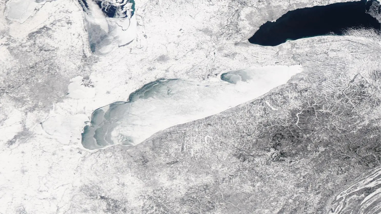
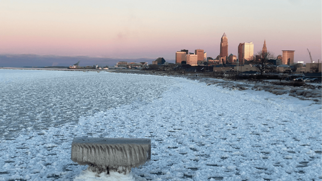
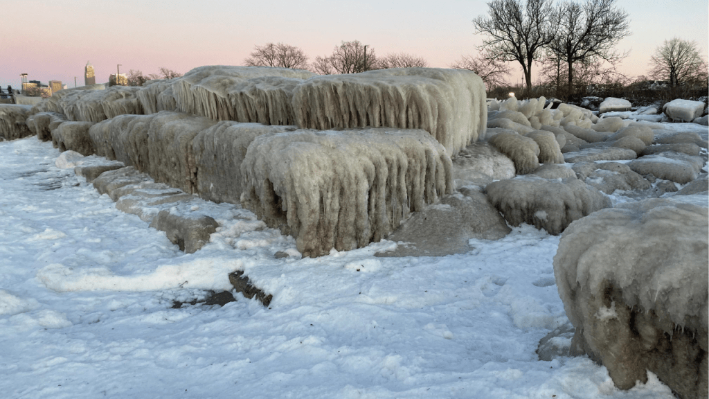
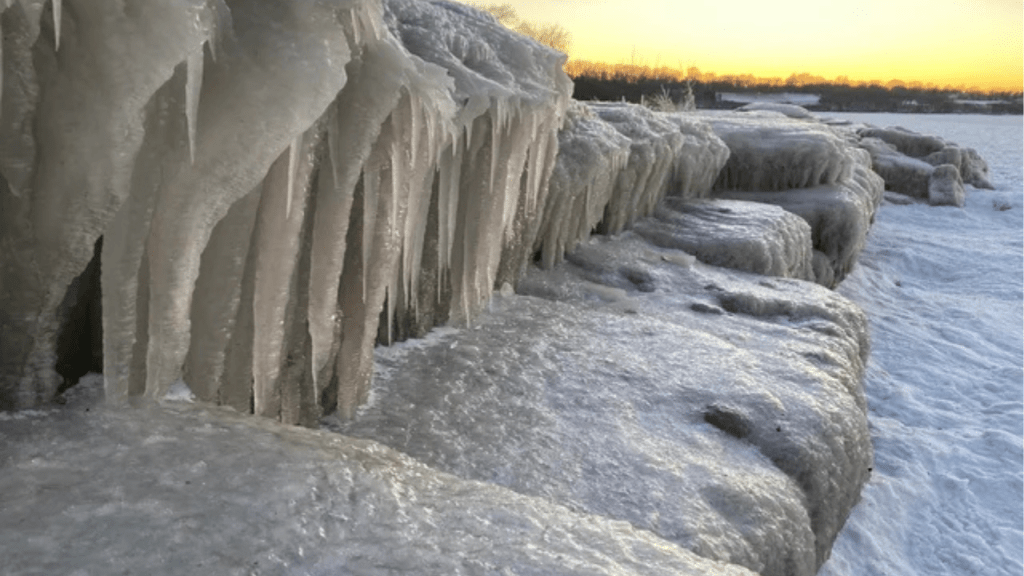
Lake Erie is nearing complete freezing after an Arctic cold snap. NOAA data and UPI reports indicate that the lake has nearly 95% ice cover, an unusual level that has reignited scientific and media interest in its winter state. The phenomenon is wind-dependent.
Current situation of Lake Erie according to UPI and NOAA

According to the UPI article, the Lake Erie reached about 95.3% ice coverage, an exceptional value within modern records. The NOAA, through its Great Lakes laboratory, confirmed that the rapid expansion of ice occurred after an Arctic air intrusion pushed temperatures well below the seasonal average. Days earlier, large areas remained open water, highlighting the speed of the process.
Official records show that complete freezing is rare. Since satellite monitoring began, the lake has only reached 100% ice on a few occasions, the last one in the 1990s. For this reason, meteorologists point out that being close to that threshold is already a relevant event for regional climatology.
UPI also explains that the final percentage does not depend solely on cold. The wind can move ice sheets and open water channels, preventing the entire surface from closing even during extreme cold episodes. The NOAA uses satellite imagery and daily analyses to calculate coverage, avoiding visual estimates from the shoreline.
This monitoring makes it possible to compare the current winter with past seasons and assess whether the pattern matches other years of extensive ice. Together, both sources describe a coherent scenario: extreme temperatures, rapid ice formation, and a real, though uncertain, possibility of reaching the historical maximum.
Climatic impacts of a frozen surface
Near-continuous ice modifies the exchange of heat between the water and the atmosphere. The NOAA indicates that a frozen surface acts as insulation and can keep coastal communities colder through late winter and early spring. This effect delays the warming of nearby air and prolongs local winter conditions.
UPI reports that this ice “cap” also reduces evaporation from the lake. With less vapor available, the formation of cloudiness associated with the lake effect is limited, a process known for intensifying snowfall when water remains open. In seasons with extensive ice, that mechanism weakens.
Experts clarify that these changes do not eliminate severe weather events, but they do alter their seasonal distribution. A frozen lake tends to stabilize the air above its surface, producing calmer periods compared to winters with open water. The combination of intense cold and persistent ice explains why the current episode has attracted the attention of scientists and the media.
In summary, coverage close to the historical maximum is not only a visual fact. It represents a physical variation that influences temperature, humidity, and regional atmospheric dynamics for several weeks.
Factors that determine whether it will reach 100%
The outcome toward 100% ice depends on short-term conditions. UPI notes that strong gusts can fracture the ice layer and create water corridors even under very low temperatures. The direction of the wind and its duration are key variables in closing or reopening areas of the lake.
The NOAA monitors the surface daily with satellite sensors that distinguish compact ice, fragmented ice, and open water. This method allows accurate percentage estimates and rapid detection of changes. Official reports stress that small daily variations can shift the total figure by several points.
In addition to wind, the depth of the lake plays a role. Erie is the shallowest of the Great Lakes, which makes it more prone to freezing compared with deeper bodies of water. This feature explains why it often leads to episodes of widespread ice in the region.
Continuous monitoring also supports climate studies. Comparing winters with high coverage to years with little ice helps clarify the relationship between average temperature, atmospheric circulation, and the response of the lake system. Thus, the current event becomes part of a historical series that allows trends to be evaluated without relying on a single winter.
Information from UPI and NOAA agrees that the Lake Erie is experiencing an unusual winter episode. With coverage close to the recorded maximum, the phenomenon illustrates how extreme cold and wind shape ice dynamics and regional impacts. Official data fully support this assessment.
Reference:
- UPI/Lake Erie could hit rare 100% ice coverage. Link
- NOAA – Great Lakes Environmental Research Laboratory/Current Ice Cover Conditions. Link
COMPARTE ESTE ARTICULO EN TUS REDES FAVORITAS:

Esta entrada también está disponible en:
![]()

Discover more from Cerebro Digital
Subscribe to get the latest posts sent to your email.